Rock Pointing the Way to go
The Crown King Scramble is a new, old race. What I mean by that is that it is a revival of a race from times of yore. Once again, the boys over at Aravaipa Running put on a stellar event. This race was one that appealed to me due to the point-to-point nature and it seemed more of an adventure than a race. The race starts at Lake Pleasant and ends in the small mining town of Crown King. Uphill the entire way! Here is a little background on the restart of this iconic event: The Resurrection
Night Before
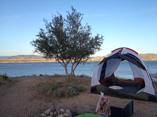
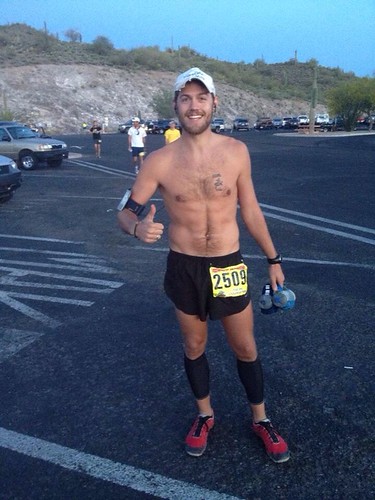
Now on to the 2013 version of the CKS. I went into this race with a general confidence that I would be able to do well but I knew that the entire uphill nature of the event would prove to be difficult. I was also going into this without my normal crew (not there was crew access anyway). Instead, I was given the pleasure of camping out the night before with my buddy Keaton. He may have caught the ultrarunning bug. I hope. We camped out right on Lake Pleasant within rock-throwing distance of the start line. After setting up our tent we spent the evening skipping stones and looking longingly into one another's eyes....kidding. After the normal camping shenanigans, we feasted on scrumptious hot dogs, bear claws, and too many root beers before hitting the hay. I was quite excited so sleep did not come easy and 5am came quickly. Due to the proximity of our campsite, I was able to roll over and watch the early start from my tent. I finally decided to get up and go through my pre-race rituals. I ate some more bear claws...too many to be exact and soon it was time to start.
 |
| Our Campsite |
 |
| Pre-Race Cheesing |
 |
| Start line |
 |
| Sun coming up over the lake behind us. |
I left the Cow Creek aid station alone, which I didn't mind, and quickly settled into a rhythm. I decided to slow down because the day was getting hot and I wanted to be able to survive the ensuing climb. The dirt road started to narrow and wind a bit more and the views were incredible. We also began to pass some of the early starters which was fun getting and giving encouragement from them. I soon noticed that my legs felt particularly heavy and my left foot was starting to feel a bit weird. I had been having some issues with my Plantar Fascia region for a while but it never seemed that serious. Earlier in the day I had been running with Jamil and I told myself that I should just stay with him as he is a more seasoned runner than I. Of course the early race good feelings took over and I was out ahead of him up until about mile 14. A mile out from the aid station Jamil clinically passed me on the uphill and offered some encouragement as I told him I was feeling kind of rough. The French Creek Aid station was adorned Tropical Style and I took some time to refill my food and get ready for what was next. I made sure not to hang too long in the aid station as I would get sucked in by the party they were having.
French Creek-Silver Mountain-Mile 15.3-19.1
Immediately after leaving the French Creek Aid station, the course gets a obvious face lift. The lull of the dirt road is transformed into unpredictable jeep road and starts going uphill a bit more drastically. I am used to running on jeep roads as much of my weekend training is on jeep roads around Wickenburg but I was already a bit tired from the rolling hills I had been on the previous 15 miles. The course was still beautiful and I would often look back to see the lake and you could no longer see the top of what we were running to so it did not seem as daunting. My goal at this time was to try to not fall any more in the standings and stay ahead of the 1st place female. The course was still a lot of fun and there were some very sharp down hills that I would've loved to see the leaders bomb down. If you look at the Garmin Data below you'll notice that Mile 15 is the last sub 10-min mile I ran until the final downhill 10+ miles later. As I came into the Silver Mountain Aid Station I made sure to take in the view and thanked the aid workers for being up there is this aid station seemed like a real trick to get to. As I was leaving the lead female came into the aid. I now made it my personal goal to stay ahead of her at all costs.
Silver Mountain-Fort Misery-Mile 19.1-22.3
Although there was only 3 miles or so between these 2 aid stations, it still took me over 30 minutes to cover that distance. The course was still going up and down, but mainly up as we wound our way through the lower Bradshaw mountains. I made sure to take time to dip my hat at every stream crossing but there were not many of those to speak of as of yet. I was still hiking quite well but my downhill legs were starting to hurt. I guess its a good thing this race is mainly uphill! The day was starting to heat up and because the course followed a stream, there wasn't a lot of moving air. Things were getting hot. COming into the Fort Misery Aid station, I was given a lovely mist shower by one of the aid station workers. Again, I had the problem of too much food on board due to my over planning and overfilling of drop bags. I made sure to eat and take in some liquids and quickly made it out of the aid station before the lead female came in.
 |
| Shuffling along after Fort Misery |
Fort Misery-Oro Bell-Mile 22.3-27
After leaving Fort Misery, I noticed the course stopped going up and down as much and we mainly were going up. We were also leap frogging over a stream every half mile or so. This was nice to get a chance to soak my hat and cool down. I even thought about sitting in the stream for a bit but I wanted to make sure to stay ahead of the lead lady. Then at about mile 24 or so, I was met with what would be the biggest challenge of the day. The course takes a sharp turn and then goes up....and up....and up...for what seemed like 10 miles. Looking back it was probably closer to 4 or so but it was long. The gradient wouldn't be bad if one were fresh, but I was far from fresh. I did my best to run what I could but most of it was hiking. I settled into a decent run/hike rhythm but it was obvious that I was losing ground. I kept looking back and noticed that I was being caught by another male runner but was not able to see the lady's leader. As we made our way up the hill I noticed that the cactus were now becoming larger trees. Were gaining elevation and the cacti were giving way to pines. Pretty awesome! I also noticed that many of the bushes were littered with ladies undergarments. At first I thought it was from weekenders having a good time in the 4x4s but then saw the signs for the Oro Bell aid station. I was a little concerned if this was going to be an aid station run by nudists. I was soon caught by the next guy and did my best to stay with him but he was hiking better than I was. At the Oro Bell aid station, I was met by an enthusiast, fully clothed group of volunteers who poured a whole pitcher of water over my head. This aid station got my vote for best aid station, even if they did lie and tell me we were almost to the top of the climb.
 |
| Getting passed on the climb up to Oro Bell |
 |
| About to get a shower |
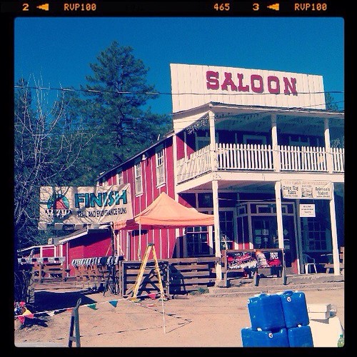
After my shower at Oro Bell, I left the aid station with Scott Modzelewski. We ran together the rest of climb and it was nice to have some company. We were now on forest road in alpine pine forests and the air seemed cooler up here. At about mile 28 we crested the "forever" hill as I like to call it and it was all down hill from here. My legs were not used to running but I was soon able to find my rhythm and I felt like I was flying after having hiked the last 6 miles or so. Having never been to Crown King, I didn't know what to expect. The only prior knowledge I had of the town was this picture of the finish line.
I soon heard the cheers of the town and snaked my way through the dirt "streets" to the finish. I ended up finishing 23rd overall in a time of 5:35 which is better than my first 50k time so I was pleased. The food, beer, and most especially the awesome beer mug we received at the finish line were awesome. This race will be one I plan on doing for years to come. It is already on my calendar for next year!


No comments:
Post a Comment